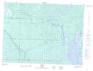
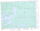
Maps showing Dexter Creek, Thunder Bay, Ontario
Dexter Creek is a River located in Thunder Bay, Ontario and has an elevation of 470 meters.
- Latitude: 48° 53' 6'' North (decimal: 48.8850000)
- Longitude: 90° 2' 7'' West (decimal: -90.0352777)
- Topography Feature Category: River
- Geographical Feature: Creek
- Canadian Province/Territory: Ontario
- Elevation: 470 meters
- Location: Thunder Bay
- Atlas of Canada Locator Map: Dexter Creek
- GPS Coordinate Locator Map: Dexter Creek Lat/Long
Dexter Creek NTS Map Sheets