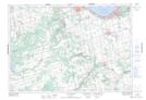
Maps showing Dey's Pond, Grey, Ontario
Dey's Pond is a Lake located in Grey, Ontario and has an elevation of 484 meters.
- Latitude: 44° 25' 00'' North (decimal: 44.4166666)
- Longitude: 80° 22' 34'' West (decimal: -80.3761111)
- Topography Feature Category: Lake
- Geographical Feature: Pond
- Canadian Province/Territory: Ontario
- Elevation: 484 meters
- Location: Grey
- Atlas of Canada Locator Map: Dey's Pond
- GPS Coordinate Locator Map: Dey's Pond Lat/Long
Dey's Pond NTS Map Sheets