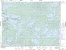
Maps showing Dirtywater Creek, Kenora, Ontario
Dirtywater Creek is a River located in Kenora, Ontario and has an elevation of 338 meters.
- Latitude: 49° 29' 22'' North (decimal: 49.4894444)
- Longitude: 93° 55' 50'' West (decimal: -93.9305555)
- Topography Feature Category: River
- Geographical Feature: Creek
- Canadian Province/Territory: Ontario
- Elevation: 338 meters
- Location: Kenora
- Atlas of Canada Locator Map: Dirtywater Creek
- GPS Coordinate Locator Map: Dirtywater Creek Lat/Long