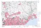
Maps showing Dicksons Hill, York, Ontario
Dicksons Hill is a Mountain located in York, Ontario and has an elevation of 244 meters.
- Latitude: 43° 56' 36'' North (decimal: 43.9433333)
- Longitude: 79° 16' 33'' West (decimal: -79.2758333)
- Topography Feature Category: Mountain
- Geographical Feature: Hill
- Canadian Province/Territory: Ontario
- Elevation: 244 meters
- Location: York
- Atlas of Canada Locator Map: Dicksons Hill
- GPS Coordinate Locator Map: Dicksons Hill Lat/Long