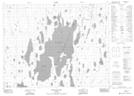
Maps showing Manidosh Island, Cochrane, Ontario
Manidosh Island is a Island located in Cochrane, Ontario and has an elevation of 255 meters.
- Latitude: 50° 24' 53'' North (decimal: 50.4147222)
- Longitude: 80° 13' 58'' West (decimal: -80.2327777)
- Topography Feature Category: Island
- Geographical Feature: Island
- Canadian Province/Territory: Ontario
- Elevation: 255 meters
- Location: Cochrane
- Atlas of Canada Locator Map: Manidosh Island
- GPS Coordinate Locator Map: Manidosh Island Lat/Long
Manidosh Island NTS Map Sheets