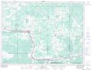
Maps showing Manitou Creek, Rainy River, Ontario
Manitou Creek is a River located in Rainy River, Ontario and has an elevation of 341 meters.
- Latitude: 48° 38' 10'' North (decimal: 48.6361111)
- Longitude: 93° 54' 23'' West (decimal: -93.9063888)
- Topography Feature Category: River
- Geographical Feature: Creek
- Canadian Province/Territory: Ontario
- Elevation: 341 meters
- Location: Rainy River
- Atlas of Canada Locator Map: Manitou Creek
- GPS Coordinate Locator Map: Manitou Creek Lat/Long
Manitou Creek NTS Map Sheets