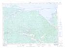
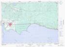
Maps showing Manitou Islands, Nipissing, Ontario
Manitou Islands is a Island located in Nipissing, Ontario and has an elevation of 206 meters.
- Latitude: 46° 16' 10'' North (decimal: 46.2694444)
- Longitude: 79° 33' 38'' West (decimal: -79.5605555)
- Topography Feature Category: Island
- Geographical Feature: Islands
- Canadian Province/Territory: Ontario
- Elevation: 206 meters
- Location: Nipissing
- Atlas of Canada Locator Map: Manitou Islands
- GPS Coordinate Locator Map: Manitou Islands Lat/Long
Manitou Islands NTS Map Sheets