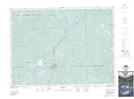
Maps showing Mannajigama Bay, Timiskaming, Ontario
Mannajigama Bay is a Bay located in Timiskaming, Ontario and has an elevation of 345 meters.
- Latitude: 47° 14' 25'' North (decimal: 47.2402777)
- Longitude: 79° 54' 27'' West (decimal: -79.9075000)
- Topography Feature Category: Bay
- Geographical Feature: Bay
- Canadian Province/Territory: Ontario
- Elevation: 345 meters
- Location: Timiskaming
- Atlas of Canada Locator Map: Mannajigama Bay
- GPS Coordinate Locator Map: Mannajigama Bay Lat/Long
Mannajigama Bay NTS Map Sheets