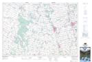
Maps showing Mullin's Mill Pond, Bruce, Ontario
Mullin's Mill Pond is a Lake located in Bruce, Ontario and has an elevation of 272 meters.
- Latitude: 44° 9' 13'' North (decimal: 44.1536111)
- Longitude: 81° 16' 21'' West (decimal: -81.2724999)
- Topography Feature Category: Lake
- Geographical Feature: Pond
- Canadian Province/Territory: Ontario
- Elevation: 272 meters
- Location: Bruce
- Atlas of Canada Locator Map: Mullin's Mill Pond
- GPS Coordinate Locator Map: Mullin's Mill Pond Lat/Long
Mullin's Mill Pond NTS Map Sheets