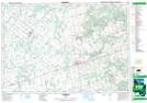
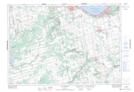
Maps showing Mulmur Hills, Dufferin; Simcoe, Ontario
Mulmur Hills is a Mountain located in Dufferin; Simcoe, Ontario and has an elevation of 364 meters.
- Latitude: 44° 10' 27'' North (decimal: 44.1741666)
- Longitude: 80° 4' 16'' West (decimal: -80.0711111)
- Topography Feature Category: Mountain
- Geographical Feature: Hills
- Canadian Province/Territory: Ontario
- Elevation: 364 meters
- Location: Dufferin; Simcoe
- Atlas of Canada Locator Map: Mulmur Hills
- GPS Coordinate Locator Map: Mulmur Hills Lat/Long
Mulmur Hills NTS Map Sheets