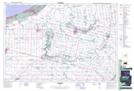
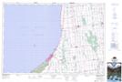
Maps showing Mud Creek, Middlesex, Ontario
Mud Creek is a River located in Middlesex, Ontario and has an elevation of 225 meters.
- Latitude: 43° 9' 57'' North (decimal: 43.1658333)
- Longitude: 81° 39' 35'' West (decimal: -81.6597222)
- Topography Feature Category: River
- Geographical Feature: Creek
- Canadian Province/Territory: Ontario
- Elevation: 225 meters
- Location: Middlesex
- Atlas of Canada Locator Map: Mud Creek
- GPS Coordinate Locator Map: Mud Creek Lat/Long
Mud Creek NTS Map Sheets