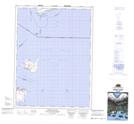
Maps showing Pelee Island South, Essex, Ontario
Pelee Island South is a Unincorporated area located in Essex, Ontario and has an elevation of 174 meters.
- Latitude: 41° 44' 35'' North (decimal: 41.7430555)
- Longitude: 82° 38' 27'' West (decimal: -82.6408333)
- Topography Feature Category: Unincorporated area
- Geographical Feature: Dispersed Rural Community
- Canadian Province/Territory: Ontario
- Elevation: 174 meters
- Location: Essex
- Atlas of Canada Locator Map: Pelee Island South
- GPS Coordinate Locator Map: Pelee Island South Lat/Long
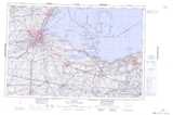
Pelee Island South NTS Map Sheets