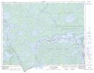
Maps showing Myrtle Falls, Rainy River, Ontario
Myrtle Falls is a Falls located in Rainy River, Ontario and has an elevation of 363 meters.
- Latitude: 48° 24' 42'' North (decimal: 48.4116666)
- Longitude: 92° 11' 14'' West (decimal: -92.1872222)
- Topography Feature Category: Falls
- Geographical Feature: Falls
- Canadian Province/Territory: Ontario
- Elevation: 363 meters
- Location: Rainy River
- Atlas of Canada Locator Map: Myrtle Falls
- GPS Coordinate Locator Map: Myrtle Falls Lat/Long
Myrtle Falls NTS Map Sheets