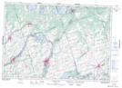
Maps showing Peloe Island, Northumberland, Ontario
Peloe Island is a Island located in Northumberland, Ontario and has an elevation of 167 meters.
- Latitude: 44° 20' 23'' North (decimal: 44.3397222)
- Longitude: 77° 46' 26'' West (decimal: -77.7738888)
- Topography Feature Category: Island
- Geographical Feature: Island
- Canadian Province/Territory: Ontario
- Elevation: 167 meters
- Location: Northumberland
- Atlas of Canada Locator Map: Peloe Island
- GPS Coordinate Locator Map: Peloe Island Lat/Long
Peloe Island NTS Map Sheets