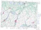
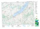
Maps showing Percy Creek, Northumberland, Ontario
Percy Creek is a River located in Northumberland, Ontario and has an elevation of 250 meters.
- Latitude: 44° 15' 2'' North (decimal: 44.2505555)
- Longitude: 77° 49' 2'' West (decimal: -77.8172222)
- Topography Feature Category: River
- Geographical Feature: Creek
- Canadian Province/Territory: Ontario
- Elevation: 250 meters
- Location: Northumberland
- Atlas of Canada Locator Map: Percy Creek
- GPS Coordinate Locator Map: Percy Creek Lat/Long
Percy Creek NTS Map Sheets