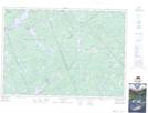
Maps showing McGonegal Lake, Lanark, Ontario
McGonegal Lake is a Lake located in Lanark, Ontario and has an elevation of 233 meters.
- Latitude: 45° 12' 21'' North (decimal: 45.2058333)
- Longitude: 76° 39' 52'' West (decimal: -76.6644444)
- Topography Feature Category: Lake
- Geographical Feature: Lake
- Canadian Province/Territory: Ontario
- Elevation: 233 meters
- Location: Lanark
- Atlas of Canada Locator Map: McGonegal Lake
- GPS Coordinate Locator Map: McGonegal Lake Lat/Long
McGonegal Lake NTS Map Sheets