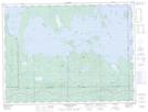
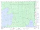
Maps showing The Narrows, Cochrane, Ontario
The Narrows is a Channel located in Cochrane, Ontario and has an elevation of 273 meters.
- Latitude: 48° 44' 51'' North (decimal: 48.7475000)
- Longitude: 79° 53' 55'' West (decimal: -79.8986111)
- Topography Feature Category: Channel
- Geographical Feature: Narrows
- Canadian Province/Territory: Ontario
- Elevation: 273 meters
- Location: Cochrane
- Atlas of Canada Locator Map: The Narrows
- GPS Coordinate Locator Map: The Narrows Lat/Long
The Narrows NTS Map Sheets