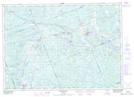
Maps showing Needles Eye Rapids, Ontario
Needles Eye Rapids is a Rapids located in Ontario and has an elevation of 248 meters.
- Latitude: 45° 43' 27'' North (decimal: 45.7241999)
- Longitude: 79° 56' 59'' West (decimal: -79.9497000)
- Topography Feature Category: Rapids
- Geographical Feature: Rapids
- Canadian Province/Territory: Ontario
- Elevation: 248 meters
- GPS Coordinate Locator Map: Needles Eye Rapids Lat/Long
Needles Eye Rapids NTS Map Sheets