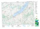
Maps showing Margaret Island, Northumberland, Ontario
Margaret Island is a Island located in Northumberland, Ontario and has an elevation of 208 meters.
- Latitude: 44° 14' 42'' North (decimal: 44.2450000)
- Longitude: 78° 4' 44'' West (decimal: -78.0788888)
- Topography Feature Category: Island
- Geographical Feature: Island
- Canadian Province/Territory: Ontario
- Elevation: 208 meters
- Location: Northumberland
- Atlas of Canada Locator Map: Margaret Island
- GPS Coordinate Locator Map: Margaret Island Lat/Long
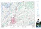
Margaret Island NTS Map Sheets