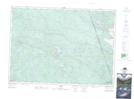
Maps showing Marilyn Creek, Renfrew, Ontario
Marilyn Creek is a River located in Renfrew, Ontario and has an elevation of 207 meters.
- Latitude: 45° 58' 17'' North (decimal: 45.9713888)
- Longitude: 77° 35' 6'' West (decimal: -77.5849999)
- Topography Feature Category: River
- Geographical Feature: Creek
- Canadian Province/Territory: Ontario
- Elevation: 207 meters
- Location: Renfrew
- Atlas of Canada Locator Map: Marilyn Creek
- GPS Coordinate Locator Map: Marilyn Creek Lat/Long