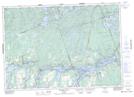
Maps showing Caldwell Island, Peterborough, Ontario
Caldwell Island is a Island located in Peterborough, Ontario.
- Latitude: 44° 32' 11'' North (decimal: 44.5363888)
- Longitude: 78° 9' 20'' West (decimal: -78.1555555)
- Topography Feature Category: Island
- Geographical Feature: Island
- Canadian Province/Territory: Ontario
- Location: Peterborough
- Atlas of Canada Locator Map: Caldwell Island
- GPS Coordinate Locator Map: Caldwell Island Lat/Long
Caldwell Island NTS Map Sheets