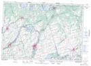
Maps showing Blue Hole, Northumberland, Ontario
Blue Hole is a Channel located in Northumberland, Ontario and has an elevation of 116 meters.
- Latitude: 44° 14' 53'' North (decimal: 44.2480555)
- Longitude: 77° 43' 19'' West (decimal: -77.7219444)
- Topography Feature Category: Channel
- Geographical Feature: Hole
- Canadian Province/Territory: Ontario
- Elevation: 116 meters
- Location: Northumberland
- Atlas of Canada Locator Map: Blue Hole
- GPS Coordinate Locator Map: Blue Hole Lat/Long
Blue Hole NTS Map Sheets