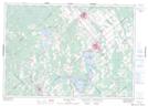
Maps showing McIntyre Creek, Lanark, Ontario
McIntyre Creek is a River located in Lanark, Ontario and has an elevation of 151 meters.
- Latitude: 45° 1' 56'' North (decimal: 45.0322222)
- Longitude: 76° 13' 40'' West (decimal: -76.2277777)
- Topography Feature Category: River
- Geographical Feature: Creek
- Canadian Province/Territory: Ontario
- Elevation: 151 meters
- Location: Lanark
- Atlas of Canada Locator Map: McIntyre Creek
- GPS Coordinate Locator Map: McIntyre Creek Lat/Long
McIntyre Creek NTS Map Sheets