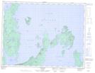
Maps showing McIntyre Island, Thunder Bay, Ontario
McIntyre Island is a Island located in Thunder Bay, Ontario and has an elevation of 250 meters.
- Latitude: 49° 31' 00'' North (decimal: 49.5166666)
- Longitude: 88° 54' 43'' West (decimal: -88.9119444)
- Topography Feature Category: Island
- Geographical Feature: Island
- Canadian Province/Territory: Ontario
- Elevation: 250 meters
- Location: Thunder Bay
- Atlas of Canada Locator Map: McIntyre Island
- GPS Coordinate Locator Map: McIntyre Island Lat/Long