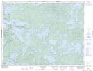
Maps showing McKay Island, Kenora, Ontario
McKay Island is a Island located in Kenora, Ontario.
- Latitude: 49° 23' 15'' North (decimal: 49.3874999)
- Longitude: 93° 47' 59'' West (decimal: -93.7997222)
- Topography Feature Category: Island
- Geographical Feature: Island
- Canadian Province/Territory: Ontario
- Location: Kenora
- Atlas of Canada Locator Map: McKay Island
- GPS Coordinate Locator Map: McKay Island Lat/Long