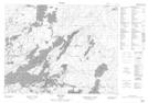
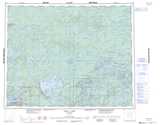
Maps showing McKenzie Island, Kenora, Ontario
McKenzie Island is a Unincorporated area located in Kenora, Ontario.
- Latitude: 51° 4' 24'' North (decimal: 51.0733333)
- Longitude: 93° 49' 40'' West (decimal: -93.8277777)
- Topography Feature Category: Unincorporated area
- Geographical Feature: Compact Rural Community
- Canadian Province/Territory: Ontario
- Location: Kenora
- Atlas of Canada Locator Map: McKenzie Island
- GPS Coordinate Locator Map: McKenzie Island Lat/Long
McKenzie Island NTS Map Sheets