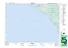
Maps showing McLander Marsh, Bruce, Ontario
McLander Marsh is a Low vegetation located in Bruce, Ontario and has an elevation of 204 meters.
- Latitude: 45° 11' 55'' North (decimal: 45.1986111)
- Longitude: 81° 32' 52'' West (decimal: -81.5477777)
- Topography Feature Category: Low vegetation
- Geographical Feature: Marsh
- Canadian Province/Territory: Ontario
- Elevation: 204 meters
- Location: Bruce
- Atlas of Canada Locator Map: McLander Marsh
- GPS Coordinate Locator Map: McLander Marsh Lat/Long
McLander Marsh NTS Map Sheets