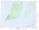
Maps showing Silver Islet, Thunder Bay, Ontario
Silver Islet is a Unincorporated area located in Thunder Bay, Ontario and has an elevation of 194 meters.
- Latitude: 48° 19' 50'' North (decimal: 48.3305555)
- Longitude: 88° 49' 21'' West (decimal: -88.8224999)
- Topography Feature Category: Unincorporated area
- Geographical Feature: Dispersed Rural Community
- Canadian Province/Territory: Ontario
- Elevation: 194 meters
- Location: Thunder Bay
- Atlas of Canada Locator Map: Silver Islet
- GPS Coordinate Locator Map: Silver Islet Lat/Long
Silver Islet NTS Map Sheets