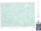
Maps showing Otter Lake, Parry Sound, Ontario
Otter Lake is a Unincorporated area located in Parry Sound, Ontario and has an elevation of 207 meters.
- Latitude: 45° 17' 32'' North (decimal: 45.2922222)
- Longitude: 79° 56' 45'' West (decimal: -79.9458333)
- Topography Feature Category: Unincorporated area
- Geographical Feature: Railway Point
- Canadian Province/Territory: Ontario
- Elevation: 207 meters
- Location: Parry Sound
- Atlas of Canada Locator Map: Otter Lake
- GPS Coordinate Locator Map: Otter Lake Lat/Long
Otter Lake NTS Map Sheets