Maps showing Rivière des Outaouais, Prescott, Ontario
Rivière des Outaouais is a River located in Prescott, Ontario and has an elevation of 45 meters.
- Latitude: 45° 34' North (decimal: 45.5666999)
- Longitude: 74° 23' West (decimal: -74.3832999)
- Topography Feature Category: River
- Geographical Feature: Rivière
- Canadian Province/Territory: Ontario
- Elevation: 45 meters
- Location: Prescott
- Atlas of Canada Locator Map: Rivière des Outaouais
- GPS Coordinate Locator Map: Rivière des Outaouais Lat/Long
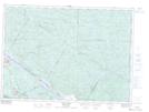
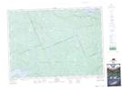
Rivière des Outaouais NTS Map Sheets
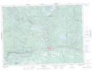
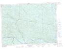
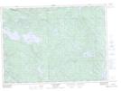
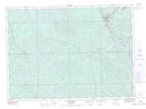
031F08 Arnprior Topographic Map at 1:50,000 scale
031F09 Quyon Topographic Map at 1:50,000 scale
031F10 Cobden Topographic Map at 1:50,000 scale
031F14 Pembroke Topographic Map at 1:50,000 scale
031F15 Fort-Coulonge Topographic Map at 1:50,000 scale
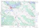
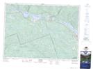
031G05 Ottawa Topographic Map at 1:50,000 scale
031G09 Lachute Topographic Map at 1:50,000 scale
031G10 Hawkesbury Topographic Map at 1:50,000 scale
031G11 Thurso Topographic Map at 1:50,000 scale
031G12 Wakefield Topographic Map at 1:50,000 scale
031K03 Chalk River Topographic Map at 1:50,000 scale
031K04 Rolphton Topographic Map at 1:50,000 scale
031L01 Brent Topographic Map at 1:50,000 scale
031L07 Mattawa Topographic Map at 1:50,000 scale
031L08 Riviere Maganasipi Topographic Map at 1:50,000 scale
031L10 Lac Beauchene Topographic Map at 1:50,000 scale
031L11 Temiscaming Topographic Map at 1:50,000 scale
031L14 Ottertail Creek Topographic Map at 1:50,000 scale
031M03 Fabre Topographic Map at 1:50,000 scale
031M05 Cobalt Topographic Map at 1:50,000 scale
031M06 Ville-Marie Topographic Map at 1:50,000 scale
031M12 New Liskeard Topographic Map at 1:50,000 scale
031F Pembroke Topographic Map at 1:250,000 scale
031G Ottawa Topographic Map at 1:250,000 scale
031K Deep River Topographic Map at 1:250,000 scale
031L North Bay Topographic Map at 1:250,000 scale
031M Ville-Marie Topographic Map at 1:250,000 scale