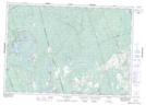
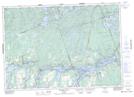
Maps showing Nephton, Peterborough, Ontario
Nephton is a Unincorporated area located in Peterborough, Ontario and has an elevation of 272 meters.
- Latitude: 44° 37' 20'' North (decimal: 44.6222222)
- Longitude: 78° 0' 19'' West (decimal: -78.0052777)
- Topography Feature Category: Unincorporated area
- Geographical Feature: Compact Rural Community
- Canadian Province/Territory: Ontario
- Elevation: 272 meters
- Location: Peterborough
- Atlas of Canada Locator Map: Nephton
- GPS Coordinate Locator Map: Nephton Lat/Long
Nephton NTS Map Sheets