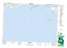
Maps showing Nicholson Island, Prince Edward, Ontario
Nicholson Island is a Island located in Prince Edward, Ontario and has an elevation of 77 meters.
- Latitude: 43° 55' 1'' North (decimal: 43.9169444)
- Longitude: 77° 31' 14'' West (decimal: -77.5205555)
- Topography Feature Category: Island
- Geographical Feature: Island
- Canadian Province/Territory: Ontario
- Elevation: 77 meters
- Location: Prince Edward
- Atlas of Canada Locator Map: Nicholson Island
- GPS Coordinate Locator Map: Nicholson Island Lat/Long