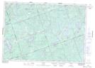
Maps showing Phillip's Marsh, Hastings, Ontario
Phillip's Marsh is a Low vegetation located in Hastings, Ontario and has an elevation of 334 meters.
- Latitude: 44° 51' 13'' North (decimal: 44.8536111)
- Longitude: 77° 42' 20'' West (decimal: -77.7055555)
- Topography Feature Category: Low vegetation
- Geographical Feature: Marsh
- Canadian Province/Territory: Ontario
- Elevation: 334 meters
- Location: Hastings
- Atlas of Canada Locator Map: Phillip's Marsh
- GPS Coordinate Locator Map: Phillip's Marsh Lat/Long