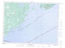
Maps showing Rolland Rock, Thunder Bay, Ontario
Rolland Rock is a Shoal located in Thunder Bay, Ontario and has an elevation of 184 meters.
- Latitude: 48° 4' 41'' North (decimal: 48.0780555)
- Longitude: 89° 19' 43'' West (decimal: -89.3286111)
- Topography Feature Category: Shoal
- Geographical Feature: Rock
- Canadian Province/Territory: Ontario
- Elevation: 184 meters
- Location: Thunder Bay
- Atlas of Canada Locator Map: Rolland Rock
- GPS Coordinate Locator Map: Rolland Rock Lat/Long
Rolland Rock NTS Map Sheets