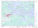
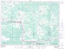
Maps showing Alberton, Rainy River, Ontario
Alberton is a Other municipal/district area - miscellaneous located in Rainy River, Ontario.
- Latitude: 48° 35' 18'' North (decimal: 48.5883333)
- Longitude: 93° 31' 13'' West (decimal: -93.5202777)
- Topography Feature Category: Other municipal/district area - miscellaneous
- Geographical Feature: Township Municipality
- Canadian Province/Territory: Ontario
- Location: Rainy River
- Atlas of Canada Locator Map: Alberton
- GPS Coordinate Locator Map: Alberton Lat/Long
Alberton NTS Map Sheets