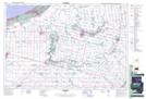
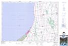
Maps showing The Pinery Provincial Park, Lambton, Ontario
The Pinery Provincial Park is a Conservation area located in Lambton, Ontario and has an elevation of 189 meters.
- Latitude: 43° 15' 31'' North (decimal: 43.2586111)
- Longitude: 81° 49' 42'' West (decimal: -81.8283333)
- Topography Feature Category: Conservation area
- Geographical Feature: Provincial Park
- Canadian Province/Territory: Ontario
- Elevation: 189 meters
- Location: Lambton
- Atlas of Canada Locator Map: The Pinery Provincial Park
- GPS Coordinate Locator Map: The Pinery Provincial Park Lat/Long
The Pinery Provincial Park NTS Map Sheets