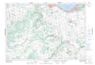
Maps showing McMurchy Settlement, Grey; Simcoe, Ontario
McMurchy Settlement is a Unincorporated area located in Grey; Simcoe, Ontario and has an elevation of 236 meters.
- Latitude: 44° 28' 40'' North (decimal: 44.4777777)
- Longitude: 80° 16' 51'' West (decimal: -80.2808333)
- Topography Feature Category: Unincorporated area
- Geographical Feature: Locality
- Canadian Province/Territory: Ontario
- Elevation: 236 meters
- Location: Grey; Simcoe
- Atlas of Canada Locator Map: McMurchy Settlement
- GPS Coordinate Locator Map: McMurchy Settlement Lat/Long
McMurchy Settlement NTS Map Sheets