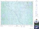
Maps showing McNamara Lake, Sudbury, Ontario
McNamara Lake is a Lake located in Sudbury, Ontario and has an elevation of 450 meters.
- Latitude: 47° 8' 00'' North (decimal: 47.1333333)
- Longitude: 81° 9' 52'' West (decimal: -81.1644444)
- Topography Feature Category: Lake
- Geographical Feature: Lake
- Canadian Province/Territory: Ontario
- Elevation: 450 meters
- Location: Sudbury
- Atlas of Canada Locator Map: McNamara Lake
- GPS Coordinate Locator Map: McNamara Lake Lat/Long