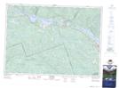
Maps showing McSourley Creek, Renfrew, Ontario
McSourley Creek is a River located in Renfrew, Ontario and has an elevation of 167 meters.
- Latitude: 46° 13' 39'' North (decimal: 46.2274999)
- Longitude: 77° 56' 47'' West (decimal: -77.9463888)
- Topography Feature Category: River
- Geographical Feature: Creek
- Canadian Province/Territory: Ontario
- Elevation: 167 meters
- Location: Renfrew
- Atlas of Canada Locator Map: McSourley Creek
- GPS Coordinate Locator Map: McSourley Creek Lat/Long
McSourley Creek NTS Map Sheets