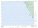
Maps showing Grandma Stevens Pond, Thunder Bay, Ontario
Grandma Stevens Pond is a Lake located in Thunder Bay, Ontario and has an elevation of 212 meters.
- Latitude: 48° 11' 38'' North (decimal: 48.1938888)
- Longitude: 86° 6' 9'' West (decimal: -86.1024999)
- Topography Feature Category: Lake
- Geographical Feature: Pond
- Canadian Province/Territory: Ontario
- Elevation: 212 meters
- Location: Thunder Bay
- Atlas of Canada Locator Map: Grandma Stevens Pond
- GPS Coordinate Locator Map: Grandma Stevens Pond Lat/Long
Grandma Stevens Pond NTS Map Sheets