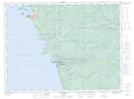
Maps showing Pic River, Thunder Bay, Ontario
Pic River is a Unincorporated area located in Thunder Bay, Ontario and has an elevation of 188 meters.
- Latitude: 48° 36' 12'' North (decimal: 48.6033333)
- Longitude: 86° 17' 49'' West (decimal: -86.2969444)
- Topography Feature Category: Unincorporated area
- Geographical Feature: Dispersed Rural Community
- Canadian Province/Territory: Ontario
- Elevation: 188 meters
- Location: Thunder Bay
- Atlas of Canada Locator Map: Pic River
- GPS Coordinate Locator Map: Pic River Lat/Long