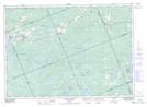
Maps showing Pigeon Bay, Parry Sound, Ontario
Pigeon Bay is a Bay located in Parry Sound, Ontario and has an elevation of 212 meters.
- Latitude: 45° 53' 42'' North (decimal: 45.8949999)
- Longitude: 79° 59' 33'' West (decimal: -79.9925000)
- Topography Feature Category: Bay
- Geographical Feature: Bay
- Canadian Province/Territory: Ontario
- Elevation: 212 meters
- Location: Parry Sound
- Atlas of Canada Locator Map: Pigeon Bay
- GPS Coordinate Locator Map: Pigeon Bay Lat/Long
Pigeon Bay NTS Map Sheets