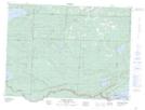
Maps showing Pigeon River, Thunder Bay, Ontario
Pigeon River is a Unincorporated area located in Thunder Bay, Ontario and has an elevation of 295 meters.
- Latitude: 48° 0' 41'' North (decimal: 48.0113888)
- Longitude: 89° 42' 27'' West (decimal: -89.7075000)
- Topography Feature Category: Unincorporated area
- Geographical Feature: Compact Rural Community
- Canadian Province/Territory: Ontario
- Elevation: 295 meters
- Location: Thunder Bay
- Atlas of Canada Locator Map: Pigeon River
- GPS Coordinate Locator Map: Pigeon River Lat/Long
Pigeon River NTS Map Sheets