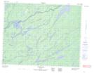
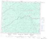
Maps showing Main Channel, Kenora; Thunder Bay, Ontario
Main Channel is a Channel located in Kenora; Thunder Bay, Ontario and has an elevation of 362 meters.
- Latitude: 51° 13' 9'' North (decimal: 51.2191666)
- Longitude: 89° 46' 55'' West (decimal: -89.7819444)
- Topography Feature Category: Channel
- Geographical Feature: Channel
- Canadian Province/Territory: Ontario
- Elevation: 362 meters
- Location: Kenora; Thunder Bay
- Atlas of Canada Locator Map: Main Channel
- GPS Coordinate Locator Map: Main Channel Lat/Long
Main Channel NTS Map Sheets