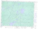
Maps showing Majata Lake, Thunder Bay, Ontario
Majata Lake is a Lake located in Thunder Bay, Ontario and has an elevation of 425 meters.
- Latitude: 49° 38' 41'' North (decimal: 49.6447222)
- Longitude: 89° 45' 6'' West (decimal: -89.7516666)
- Topography Feature Category: Lake
- Geographical Feature: Lake
- Canadian Province/Territory: Ontario
- Elevation: 425 meters
- Location: Thunder Bay
- Atlas of Canada Locator Map: Majata Lake
- GPS Coordinate Locator Map: Majata Lake Lat/Long
Majata Lake NTS Map Sheets