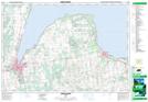
Maps showing Meaford Harbour, Grey, Ontario
Meaford Harbour is a Marine navigation feature located in Grey, Ontario and has an elevation of 178 meters.
- Latitude: 44° 36' 39'' North (decimal: 44.6108333)
- Longitude: 80° 35' 16'' West (decimal: -80.5877777)
- Topography Feature Category: Marine navigation feature
- Geographical Feature: Harbour
- Canadian Province/Territory: Ontario
- Elevation: 178 meters
- Location: Grey
- Atlas of Canada Locator Map: Meaford Harbour
- GPS Coordinate Locator Map: Meaford Harbour Lat/Long
Meaford Harbour NTS Map Sheets