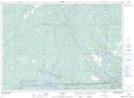
Maps showing Paget, Sudbury, Ontario
Paget is a Unincorporated area located in Sudbury, Ontario and has an elevation of 213 meters.
- Latitude: 46° 13' 47'' North (decimal: 46.2297222)
- Longitude: 80° 44' 52'' West (decimal: -80.7477777)
- Topography Feature Category: Unincorporated area
- Geographical Feature: Dispersed Rural Community
- Canadian Province/Territory: Ontario
- Elevation: 213 meters
- Location: Sudbury
- Atlas of Canada Locator Map: Paget
- GPS Coordinate Locator Map: Paget Lat/Long