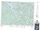
Maps showing Palmer Rapids, Renfrew, Ontario
Palmer Rapids is a Unincorporated area located in Renfrew, Ontario and has an elevation of 285 meters.
- Latitude: 45° 18' 42'' North (decimal: 45.3116666)
- Longitude: 77° 30' 25'' West (decimal: -77.5069444)
- Topography Feature Category: Unincorporated area
- Geographical Feature: Dispersed Rural Community
- Canadian Province/Territory: Ontario
- Elevation: 285 meters
- Location: Renfrew
- Atlas of Canada Locator Map: Palmer Rapids
- GPS Coordinate Locator Map: Palmer Rapids Lat/Long
Palmer Rapids NTS Map Sheets