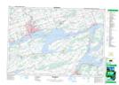
Maps showing North Port Shoal, Prince Edward, Ontario
North Port Shoal is a Shoal located in Prince Edward, Ontario.
- Latitude: 44° 8' 51'' North (decimal: 44.1475000)
- Longitude: 77° 11' 31'' West (decimal: -77.1919444)
- Topography Feature Category: Shoal
- Geographical Feature: Shoal
- Canadian Province/Territory: Ontario
- Location: Prince Edward
- Atlas of Canada Locator Map: North Port Shoal
- GPS Coordinate Locator Map: North Port Shoal Lat/Long
North Port Shoal NTS Map Sheets