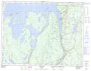
Maps showing Pine Portage, Thunder Bay, Ontario
Pine Portage is a Unincorporated area located in Thunder Bay, Ontario and has an elevation of 257 meters.
- Latitude: 49° 18' 26'' North (decimal: 49.3072222)
- Longitude: 88° 18' 43'' West (decimal: -88.3119444)
- Topography Feature Category: Unincorporated area
- Geographical Feature: Dispersed Rural Community
- Canadian Province/Territory: Ontario
- Elevation: 257 meters
- Location: Thunder Bay
- Atlas of Canada Locator Map: Pine Portage
- GPS Coordinate Locator Map: Pine Portage Lat/Long